Table of Contents
Finding other Packet peers
This service is no longer running
To participate in the OARC Packet Project stations need to find other stations that are in range in order to hopefully peer with them. We have a map of members interested in participating, but it doesn't tell us who is actually in range of one another.
To get a better idea of who can reach who without entirely re-inventing the wheel I propose we use APRS to do the work for us. There's just one catch, APRS-IS, the service that collates packets for use with services such as aprs.fi de-duplicates packets. So if two stations here the same packet and iGate it, only the fastest station to submit it to APRS-IS will be visible as receiving the packet. This makes it less useful for discovering a stations potential peers as some of this information is lost.
To work around this I've created bodged together a special APRS-IS server that intercepts packets before they're submitted to the public APRS-IS servers and stores them in a database so we can plot maps and statistics for all packets, including dupes
Disclaimer
- The service is currently in “beta”, there may be occasional outages, data loss, etc.
- It's intended for use by people interested in participating in the OARC Packet Project. An impressive amount of Packets Per Second are forwarded to APRS-IS, and if too many people start iGating to the service it'll likely fall over.
- Connecting to the service will expose your IP address to me (Matthew, 2E0SIP) and your location to the general public. If you're not happy with either of these, don't connect. You can also add some slight offset to your location if preferred.
- I don't really intend on running the service long-term, just long enough to help people find potential peers.
How do I use it?
Using the service is simple, just configure your iGate to forward packets to `aprs.2e0sip.co.uk`. This usually involves replacing something that looks like `region.aprs2.net` in your config.
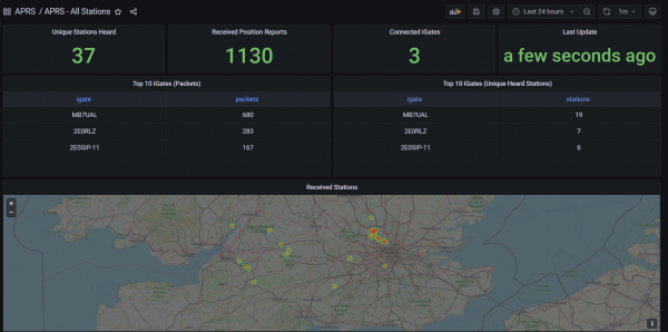
Once you've started to beacon your location and send packets you should start to appear on the Grafana instance at https://aprs-grafana.2e0sip.co.uk/. The “APRS - Filtered” Dashboard allows you to see stats and maps for your iGate only (Select it top left) and the “APRS - All Stations” shows a map and stats for all connected stations. You can adjust the timeframe in the top right corner.
You can also view a more traditional “Track Direct” APRS style map at http://aprs.2e0sip.co.uk/ but note that packets are de-duplicated.
Things worth noting
- All your packets (including those that have been received by a digipeater) will continue to be forwarded to the public APRS-IS servers and appear on aprs.fi etc
- Packets you have received via a Digipeater will be ignored by the Track Direct and Grafana services. Only packets received directly will be shown.
- Please ensure you're beaconing your iGate location to APRS-IS and not just over RF. This is so your station appears on the map.
