This is an old revision of the document!
Intro
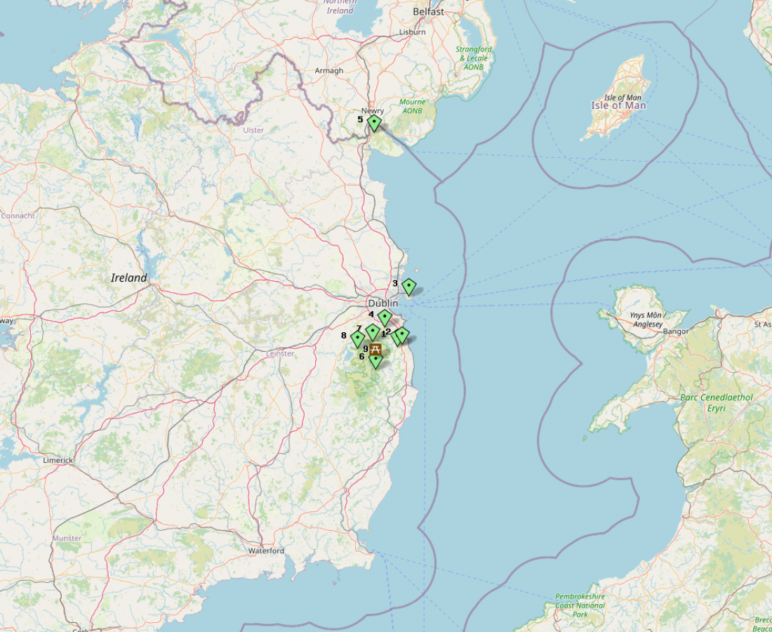
The East Leinster ARC in EI land, is planning another 4 Summits (might be just 3, we'll see what happens) on 4m between Christmas and New Years Day. The summits will be on the east coast of Ireland in Wicklow and/or Cooley Mountains. So QSO's into GW and north east G will be highly probable, especially on 4m. The primary event date is Thursday 29th Dec. with Friday 30th as an alternate date. The weather will be the main factor. We'll post an update soon with summit locations and frequency's.
Map
If you can't see list below map try CTRL-F5 or clear cache for page
operating instructions
Various functions are available as part of the map.
mouse/touch operation
- moving by grabbing the map with a mouse-click you can move the map around
- overview map using the < button in the bottom right of the map you can expand an overview map
- zooming in and out using the + and - buttons in the top left of the map you can obtain more or less detail in the map
- switching themes or maps clicking on the ≡ icon on the right-hand side of the map you can view and select available maps and themes
- retrieving information the map may contain elements that contain more information, by clicking these a popup will show this information
- fullscreen display using the ⛶ button the map can be maximized to fullscreen display, use the ▢ button to return to page display.
keyboard operation
Keyboard operation becomes available after activating the map using the tab key (the map will show a focus indicator ring).
- moving using the arrow keys you can move the map
- overview map using the + button in the bottom right of the map you can expand an overview map
- zooming in and out using the + and - buttons in the top left of the map or by using the + and - keys you can obtain more or less detail in the map
- switching themes or maps clicking on the ≡ icon on the right-hand side of the map you can view and select available maps and themes
- retrieving information the map may contain elements that contain more information, using the i key you can activate a cursor that may be moved using the arrow keys, pressing the enter will execute an information retrieval. press the i or the escape key to return to navigation mode
- fullscreen display using the ⛶ button the map can be maximized to fullscreen display, use the ▢ button to return to page display.
It's possible that some of the functions or buttons describe above have been disabled by the page author or the administrator

| id | symbol | latitude | longitude | description |
|---|---|---|---|---|
| This map shows Xmas ELARC Portable Day Locations | ||||
| 1 | 53.15416º | -6.15051º | Name CALLSIGN.. |
|
| 2 | 53.16545º | -6.11675º | Name CALLSIGN.. |
|
| 3 | 53.37339º | -6.06939º | Name CALLSIGN.. |
|
| 4 | 53.23841º | -6.24536º | Name CALLSIGN.. |
|
| 5 | 54.07925º | -6.32156º | Name CALLSIGN.. |
|
| 6 | 53.05516º | -6.31248º | Name CALLSIGN.. |
|
| 7 | 53.1782º | -6.33209º | Name CALLSIGN.. |
|
| 8 | 53.14759º | -6.44306º | Name CALLSIGN.. |
|
| 9 | 53.14308405361472º | -6.311136076727811º | Name CALLSIGN.. |
|
